Receive our Email Newsletters about upcoming Aviation Events, Great Places to Fly and Videos! Post our Flyer! Add Your Favorite Place to Fly!
Add Your Aviation Event!
The Plaza Inn
|
Best food around. Especially their country fried steak breakfast. Nice grass strip that ends right at restaurant. Runway 15-33. I go here alot. Enjoy - Submitted by Matt Miller
All destinations and events listed on this website were provided by visitors to our website. If you decide
to fly or drive to any destination listed, you do so at your own risk. Please see our disclaimer.
|
Airport Information:
|
Elliotts Landing (O74) Latitude: 40-31-29.0000N |
|
|
Location:
|
Mount Victory, OH |
Comments and Reviews From FunPlacesToFly.com Visitors:
Write a review, suggest updates or make comments!
4/10/2019 - I have flown in here several times, The runway on the restaurant side is a little rough and if it has rained it can be fun to taxi. But the food is good, the BBQ is very good. And parking right next to the restaurant is always a fun feeling. - Submitted by Joey Shreve
8/18/2014 - Appears as Elliot's Landing on sectional. Nice place. - Submitted by Jim
FunPlacesToFly.com is an Amazon Associate. As an Amazon Associate we earn from qualifying purchases.
Nearby Public Airports: (50 mile radius)
|
Photos:
All photos shown below are provided/uploaded by visitors to our website, which have agreed to our Photo Submission Rules.
Got a photo?, share it with us

The Restaurant Mt. Victory Inn - Uploaded by Joey Shreve

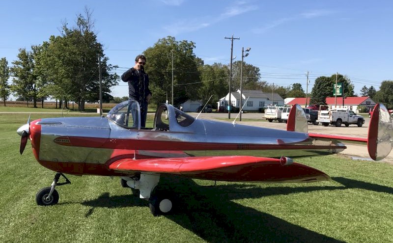
My Ercoupe parked in the Ramp Area - Uploaded by Joey Shreve

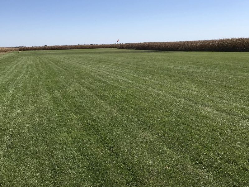
View from the Ramp to the runway - Uploaded by Joey Shreve
All photos shown below are provided/uploaded by visitors to our website, which have agreed to our Photo Submission Rules.
Got a photo?, share it with us

The Restaurant Mt. Victory Inn - Uploaded by Joey Shreve

My Ercoupe parked in the Ramp Area - Uploaded by Joey Shreve

View from the Ramp to the runway - Uploaded by Joey Shreve
Advertise with us!
 |
 |
 |
 |
 |
 |
 |
 |
 |
 |
 |
 |
 |


