
Fun Places to Fly, Aviation Jobs and More!


Horseshoe Bend Airport
Airport management. Aviation fuel. Aircraft parking (ramp or tiedown). Hangar leasing / sales. Pilots lounge / snooze room. Public telephone and Restrooms. - Submitted by Michael
All destinations and events listed on this website were provided by visitors to our website. If you decide
to fly or drive to any destination listed, you do so at your own risk. Please see our disclaimer.
|
|
Amenities:  Avgas
Courtesy Car(s)
Hangar Space
Restrooms Avgas
Courtesy Car(s)
Hangar Space
Restrooms
|
Contact Information:
Phone: 870-404-3486
Phone: 870-404-3486
Airport Information:
|
Horseshoe Bend (6M2) Latitude: 36-13-16.9300N |
|
|
Location:
|
406 S Bend Dr Horseshoe Bend, AR |
Comments and Reviews From FunPlacesToFly.com Visitors:
Write a review, suggest updates or make comments!
5/16/2024 - Los Amigos Restaurant is just a 4 minute walk from 6M2. The food is great! - Submitted by Charles Yancey
1/7/2022 - Yelp reports that both the Horseshoe Brew and Cindy's Dinner Bell have closed permanently - Submitted by Hank
Write a review, suggest updates or make comments!
5/16/2024 - Los Amigos Restaurant is just a 4 minute walk from 6M2. The food is great! - Submitted by Charles Yancey
1/7/2022 - Yelp reports that both the Horseshoe Brew and Cindy's Dinner Bell have closed permanently - Submitted by Hank
Nearby Public Airports: (50 mile radius)
|
Photos:
All photos shown below are provided/uploaded by visitors to our website, which have agreed to our Photo Submission Rules.
Got a photo?, share it with us
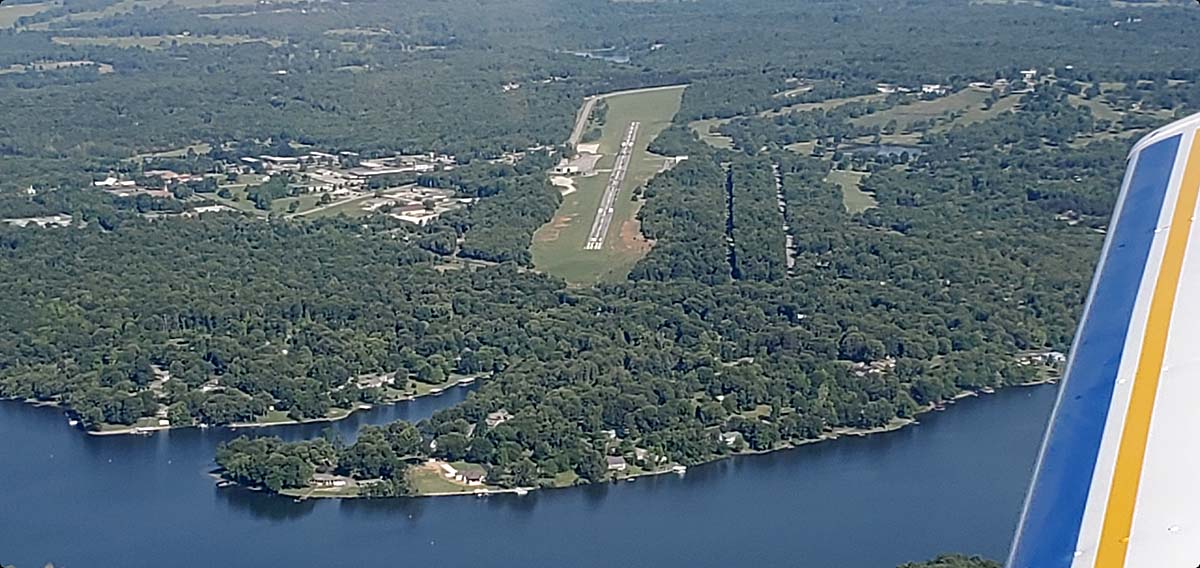
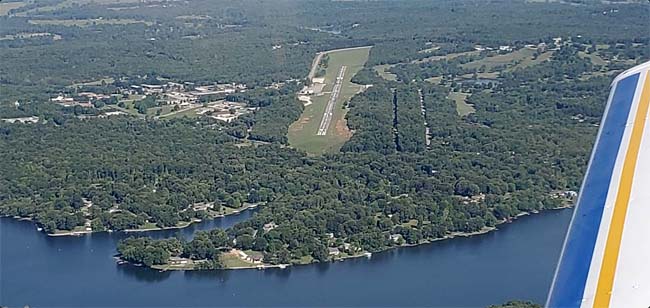
Horseshoe Bend Airport, AR - Uploaded by Ira Bodeker
All photos shown below are provided/uploaded by visitors to our website, which have agreed to our Photo Submission Rules.
Got a photo?, share it with us
Horseshoe Bend Airport, AR - Uploaded by Ira Bodeker
FunPlacesToFly.com is an Amazon Associate. As an Amazon Associate we earn from qualifying purchases.


Advertise with us!
 |
 |
 |
 |
 |
 |
 |
 |
 |
 |
 |