
Fun Places to Fly, Aviation Jobs and More!


Bedford Landings

A Stunning timber-framed Bed Breakfast waits for you right on the Runway! Land, Tie-down, Walk to the BB.!! We got a room that looked out at our plane! As close as we've ever come to sleeping with our Bonanza!! Delicious b'fast plus their Signature Specialty of Pecan Encrusted Bacon! Happy, Gracious Hosts Pilot Friendly on Pleasant Air Field, even a Crew Car! Beautiful scenery, an awesome place to fly! Highly Recommend! - Submitted by Bob J.Rogers
All destinations and events listed on this website were provided by visitors to our website. If you decide
to fly or drive to any destination listed, you do so at your own risk. Please see our disclaimer.
|
|
Amenities:  100LL
Biking
Complimentary Coffee
Courtesy Car(s)
FBO
Fishing
Food
Hiking
Hotels Near Airport
Lodging
Rental Cars
Restrooms
Self Serve 100LL
Showers
Sightseeing
Tiedowns
Transportation
WIFI 100LL
Biking
Complimentary Coffee
Courtesy Car(s)
FBO
Fishing
Food
Hiking
Hotels Near Airport
Lodging
Rental Cars
Restrooms
Self Serve 100LL
Showers
Sightseeing
Tiedowns
Transportation
WIFI
|
Airport Information:
|
Smith Mountain Lake (W91) Latitude: 37-06-27.8000N |
|
|
Location:
|
1995 Buccaneer Rd. Moneta, VA |
Comments and Reviews From FunPlacesToFly.com Visitors:
Write a review, suggest updates or make comments!
Write a review, suggest updates or make comments!
- No reviews so far
Nearby Public Airports: (50 mile radius)
|
Photos:
All photos shown below are provided/uploaded by visitors to our website, which have agreed to our Photo Submission Rules.
Got a photo?, share it with us
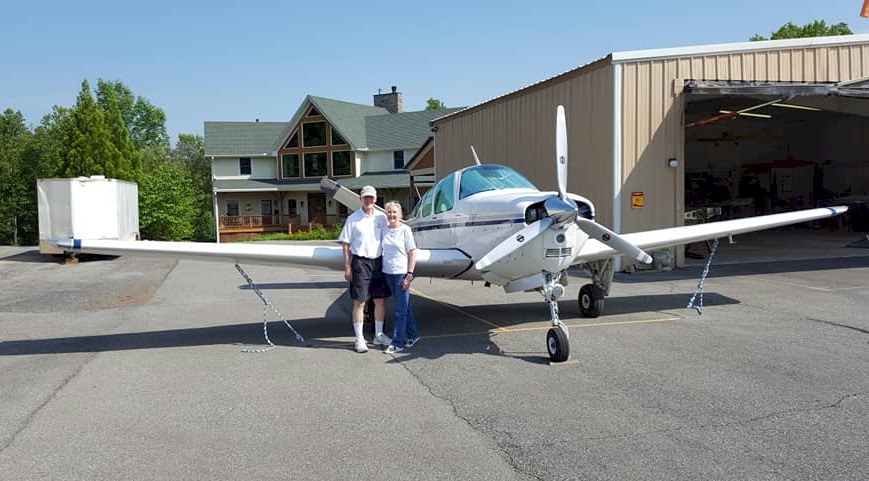
Tied-down in front of BB - Uploaded by Bob J.Rogers

Bedford Landings - Uploaded by Jim
All photos shown below are provided/uploaded by visitors to our website, which have agreed to our Photo Submission Rules.
Got a photo?, share it with us
Tied-down in front of BB - Uploaded by Bob J.Rogers
Bedford Landings - Uploaded by Jim
FunPlacesToFly.com is an Amazon Associate. As an Amazon Associate we earn from qualifying purchases.


Advertise with us!
 |
 |
 |
 |
 |
 |
 |
 |
 |
 |
 |