
Fun Places to Fly, Aviation Jobs and More!


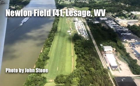
Newlon Field I41
Great place to camp and fly into, right beside the Ohio River and a great restaurant on the field. - Submitted by Walt
All destinations and events listed on this website were provided by visitors to our website. If you decide
to fly or drive to any destination listed, you do so at your own risk. Please see our disclaimer.
|
|
Amenities:  100LL
Camping
Restrooms
Showers
Tiedowns 100LL
Camping
Restrooms
Showers
Tiedowns
|
Contact Information:
Phone: 304 417-2343
Phone: 304 417-2343
Airport Information:
|
Robert Newlon Field (I41) Latitude: 38-27-25.3040N |
|
|
Location:
|
6090 Kyle Ln. Lesage, WV |
Comments and Reviews From FunPlacesToFly.com Visitors:
Write a review, suggest updates or make comments!
10/4/2020 - Cafe is great, best fish taco I could wish for. Crab cakes are my wife's go to favorite for each fly in visit. Downwind approach is always over the Ohio river and the field is in fine condition. Nearby is Ona Airpark with auto racing at the park. Look it up and injoy. - Submitted by Larry Rowse
2/18/2020 - I've flown into this stirp years ago and, after 18yrs out of the seat, I was amazed to not only find a lot of activity now but also one of the best restaurants anywhere in the entire Mid Ohio Valley. Excellent food and seafood you won't find on any other menu around. - Submitted by John Stone
Nearby Public Airports: (50 mile radius)
|
Photos:
All photos shown below are provided/uploaded by visitors to our website, which have agreed to our Photo Submission Rules.
Got a photo?, share it with us
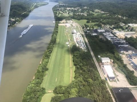
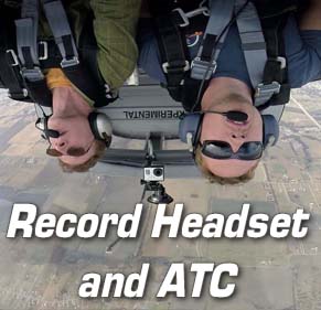
Beautiful field right along the Ohio River. Be listening for the jumpers... - Uploaded by John Stone
All photos shown below are provided/uploaded by visitors to our website, which have agreed to our Photo Submission Rules.
Got a photo?, share it with us
Beautiful field right along the Ohio River. Be listening for the jumpers... - Uploaded by John Stone
FunPlacesToFly.com is an Amazon Associate. As an Amazon Associate we earn from qualifying purchases.


Advertise with us!
 |
 |
 |
 |
 |
 |
 |
 |
 |
 |
 |