
Fun Places to Fly, Aviation Jobs and More!


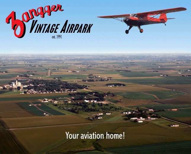
Zangger Vintage Airpark
Tail wheel friendly and well kept turf runway located adjacent to a very nice 9 hole golf course. Lunch available at the club house or the Main Street Bar and Grille has an excellent menu for lunch or dinner. - Submitted by Jim Zangger
All destinations and events listed on this website were provided by visitors to our website. If you decide
to fly or drive to any destination listed, you do so at your own risk. Please see our disclaimer.
|

Contact Information:
Phone: 712-477-2230
Phone: 712-477-2230
Airport Information:
|
Zangger Vintage Airpark (2VA) Latitude: 43-26-58.5450N |
|
|
Location:
|
1351 Airport Road N Larchwood, IA |
Comments and Reviews From FunPlacesToFly.com Visitors:
Write a review, suggest updates or make comments!
Write a review, suggest updates or make comments!
- No reviews so far
Nearby Public Airports: (50 mile radius)
|
Photos:
All photos shown below are provided/uploaded by visitors to our website, which have agreed to our Photo Submission Rules.
Got a photo?, share it with us
The Zangger family airport at Larchwood. - Uploaded by Dave
All photos shown below are provided/uploaded by visitors to our website, which have agreed to our Photo Submission Rules.
Got a photo?, share it with us
The Zangger family airport at Larchwood. - Uploaded by Dave
FunPlacesToFly.com is an Amazon Associate. As an Amazon Associate we earn from qualifying purchases.


Advertise with us!
 |
 |
 |
 |
 |
 |
 |
 |
 |
 |
 |
 |