
Fun Places to Fly, Aviation Jobs and More!


Kern Valley Airport
This is a wonderful little airport between Bakersfeild and Mojave airports, located in the mountains and around 2800 ft long. You can rent a airport car to relive 1963 all over again. You got the mighty Kern River to the North and Lake Isabela. - Submitted by David
All destinations and events listed on this website were provided by visitors to our website. If you decide
to fly or drive to any destination listed, you do so at your own risk. Please see our disclaimer.
|
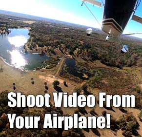
Video Created by NarbonneGauchoBoingo
|
Amenities:  Camping
Courtesy Car(s)
Food
Maintenance
Rental Cars
Tiedowns Camping
Courtesy Car(s)
Food
Maintenance
Rental Cars
Tiedowns
|
Airport Information:
|
Kern Valley (L05) Latitude: 35-43-41.6000N |
|
|
Location:
|
10649 Sierra Way Kernville, CA |
Comments and Reviews From FunPlacesToFly.com Visitors:
Write a review, suggest updates or make comments!
7/25/2002 - Kern Valley airport has a cool little diner with awesome pancakes. There are also campsites located right on the airport so you can camp and cook smores 15 feet from your airplane.
Write a review, suggest updates or make comments!
7/25/2002 - Kern Valley airport has a cool little diner with awesome pancakes. There are also campsites located right on the airport so you can camp and cook smores 15 feet from your airplane.
Nearby Public Airports: (50 mile radius)
|
Photos:
All photos shown below are provided/uploaded by visitors to our website, which have agreed to our Photo Submission Rules.
Got a photo?, share it with us
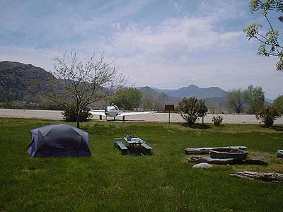
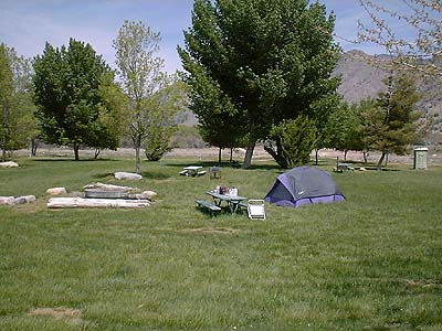
This is the view facing south from inside the campsite area. There are plenty of tiedowns adjacent to the camping. - Uploaded by Dan
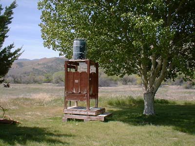
This is the view facing north into the camping area. There's an "outhouse" in the northeast corner and a shower in the southwest corner. - Uploaded by Dan
Here's the shower. - Uploaded by Dan
All photos shown below are provided/uploaded by visitors to our website, which have agreed to our Photo Submission Rules.
Got a photo?, share it with us
This is the view facing south from inside the campsite area. There are plenty of tiedowns adjacent to the camping. - Uploaded by Dan
This is the view facing north into the camping area. There's an "outhouse" in the northeast corner and a shower in the southwest corner. - Uploaded by Dan
Here's the shower. - Uploaded by Dan
FunPlacesToFly.com is an Amazon Associate. As an Amazon Associate we earn from qualifying purchases.


Advertise with us!
 |
 |
 |
 |
 |
 |
 |
 |
 |
 |
 |
 |