Aviation Events, Places to Fly and MORE!

Aviation Events Calendar
Receive our Email Newsletters about upcoming Aviation Events, Great Places to Fly and Videos! Post our Flyer!

How far is that Airport?
Distance Calculator!

Sunday, Jun 30, 2024

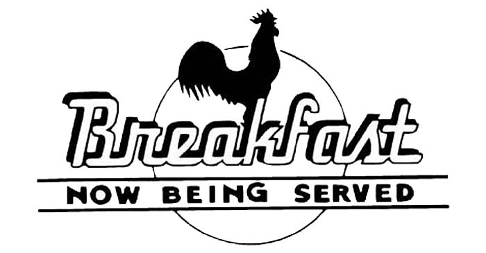
Emmetsburg Kiwanis Annual Flight Breakfast, Emmetsburg, IA

* * Search for More Events by Zip Code or Airport ID!

* * Print out a Flyer for this EVENT!

Share on:
All destinations and events listed on this website were provided by visitors to our website. If you decide to fly or drive to any destination listed, you do so at your own risk.
Please see our disclaimer.

Emmetsburg Airport (KEGQ), Emmetsburg, IA

Emmetsburg Kiwanis Club serving pancakes, omelets, sausage, coffee, or juice. Last year we had 43 planes fly in!! This year we would like to exceed that number! So please join us for breakfast on June 30. Pilots in Command eat Free, Adults $8.00 Kids 6-12 $4.00 Kids under 6 free. Thanks

Contact: Mark Evans
Phone: 712-320-0447
Email
Airport Information:
Emmetsburg Muni (EGQ)
More info from AirNav.com

Latitude: 43-06-07.4000N
Longitude: 094-42-16.3000W
Elevation: 1206
Fuel: 100LL
CTAF: 122.8
Unicom: 122.8
Input Your Airport ID:
Destination Airport ID:
Mileage Type:


See it on a Large Google Map!


FunPlacesToFly.com is an Amazon Associate. As an Amazon Associate we earn from qualifying purchases.
Nearby Public Airports: (75 mile radius)
ID Name City/State/Use Chart Name Distance
EST Estherville Muni Estherville, IA
Public
Omaha 21 miles
AXA Algona Muni Algona, IA
Public
Omaha 22 miles
POH Pocahontas Muni Pocahontas, IA
Public
Omaha 25 miles
SPW Spencer Muni Spencer, IA
Public
Omaha 26 miles
4D8 Fuller Milford, IA
Public
Omaha 28 miles
0F3 Spirit Lake Muni Spirit Lake, IA
Public
Omaha 29 miles
0K7 Humboldt Muni Humboldt, IA
Public
Omaha 34 miles
FRM Fairmont Muni Fairmont, MN
Public
Omaha 40 miles
MJQ Jackson Muni Jackson, MN
Public
Omaha 40 miles
SLB Storm Lake Muni Storm Lake, IA
Public
Omaha 44 miles
SBU Blue Earth Muni Blue Earth, MN
Public
Omaha 46 miles
2Y0 Primghar Primghar, IA
Public
Omaha 46 miles
FOD Fort Dodge Rgnl Fort Dodge, IA
Public
Omaha 46 miles
EAG Eagle Grove Muni Eagle Grove, IA
Public
Omaha 48 miles
1Y9 Paullina Muni Paullina, IA
Public
Omaha 49 miles
2Y4 Rockwell City Muni Rockwell City, IA
Public
Omaha 50 miles
CKP Cherokee County Rgnl Cherokee, IA
Public
Omaha 50 miles
SKI Sac City Muni Sac City, IA
Public
Omaha 52 miles
CAV Clarion Muni Clarion, IA
Public
Omaha 54 miles
FXY Forest City Muni Forest City, IA
Public
Omaha 55 miles
ISB Sibley Muni Sibley, IA
Public
Omaha 56 miles
SHL Sheldon Rgnl Sheldon, IA
Public
Omaha 57 miles
OTG Worthington Muni Worthington, MN
Public
Omaha 58 miles
Y48 Belmond Muni Belmond, IA
Public
Omaha 59 miles
MWM Windom Muni Windom, MN
Public
Omaha 60 miles
JYG St James Muni St James, MN
Public
Omaha 62 miles
EBS Webster City Muni Webster City, IA
Public
Omaha 63 miles
68Y Wells Muni Wells, MN
Public
Omaha 64 miles
0Y6 Lake Mills Muni Lake Mills, IA
Public
Omaha 64 miles
IDG Ida Grove Muni Ida Grove, IA
Public
Omaha 65 miles
ORC Orange City Muni Orange City, IA
Public
Omaha 69 miles
MCW Mason City Muni Mason City, IA
Public
Omaha 69 miles
CIN Arthur N Neu Carroll, IA
Public
Omaha 73 miles
SOY Sioux Center Muni Sioux Center, IA
Public
Omaha 75 miles
Fun Places to Fly Search:
Your Airport ID:
* OR *
Your Zip Code:
Range (miles):
Airport Search:
ID, Name
or City:
State:
Airport Distance Calculator:
From Airport ID:
To Airport ID:
Mileage Type:
Put this on your Website!